


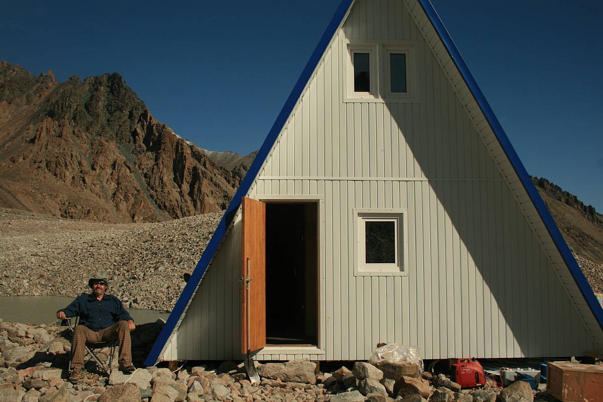
Construction of the Adygine research station
During investigations of Kyrgyz alpine lakes it became evident that long-term monitoring of changes in glacier cover and the development of glacial lakes at a representative locality was desirable to enable systematic measurement of the effects of climate change on the glacial regime. Adygine has been chosen for this purpose. It is relatively well-explored and has been monitored by the Czech-Kyrgyz expedition since 2004. It fulfils the necessary criteria, notably:
-
altitude over 3000 m above sea level
-
presence of alpine lakes at risk
-
an adjacent rapidly thawing glacier
-
a large body of data acquired during earlier investigations
-
representative of conditions prevailing over a larger region
-
relative ease of access
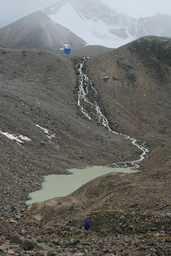
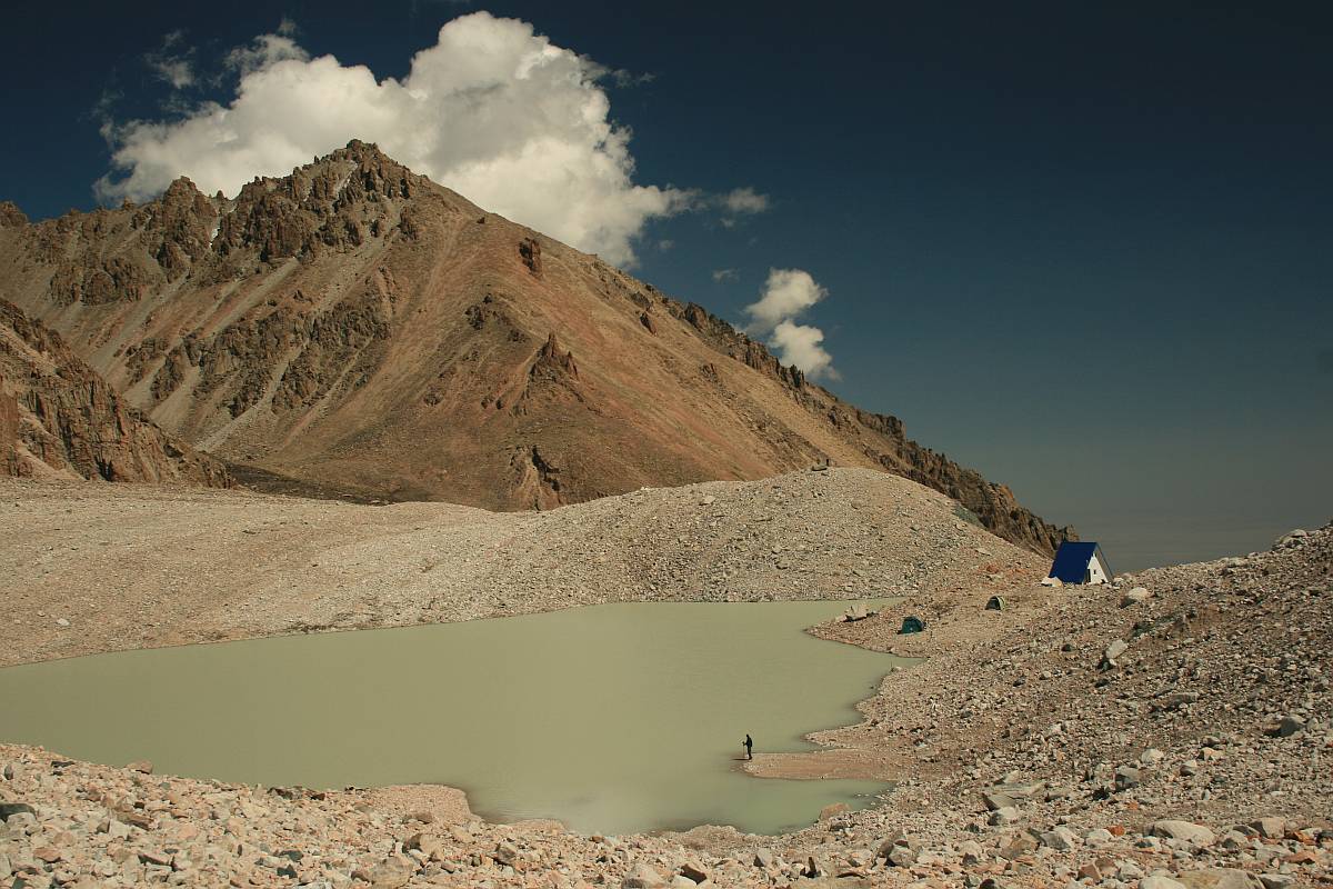
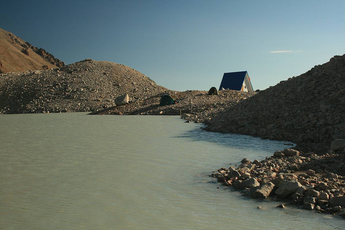
The Adygine area is a glacier-moraine complex lying at an altitude of 3 400 – 4 200 m a.s.l. The lower part is formed by a huge moraine, whereas the summit is occupied by a glacier extending as far as the crest of the Kyrgyz Ala Too mountain range. A number of lakes of various types have formed below the snout of the glacier and in the upper part of the moraine. Altogether 22 lakes are present. They include glacial lakes, lakes partly dammed by rock barriers and thermokarst lakes. Three of these lakes are considered to be potentially at risk. The development of lakes in the front of the glacier is relatively fast and changes can be monitored each year. The Adygine glacier is thawing rapidly and the rate and form of retreat and associated phenomena can be readily observed. The site is reasonably accessible and a number of reports that describe ground and aerial monitoring undertaken in the past are available. The locality and its character are representative enough so that the results of long-term monitoring can be applied to the whole of the Kyrgyz Ala Too mountain range and/or to other mountain ranges of Northern Kyrgyzstan. The results can also be compared with similar investigations carried out in other alpine mountains worldwide.
The locality can be reached from the main Ala-Archa valley via an asphalt road from the city of Bishkek. A trail passable for horses leads from the road as far as a site ca two hours walk from the lower lake. The whole path can be made passable for horses as far as the vicinity of the research station by making some modifications of the terrain.
The history of construction of the station
A private company in Bishkek was hired in the spring of 2008 to construct the whole research station. Three craftsmen assembled the main structure in their workshop and also constructed other necessary components. The structure was then dismantled and, together with other material, transported to an intermediate storehouse at the village of Baytyk.
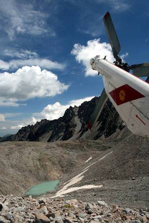
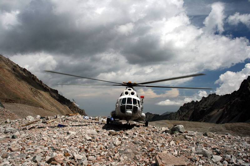
The transport of material to the construction site posed a major logistical problem. This could have been solved only by using a helicopter. The only operating helicopter in the whole of Kyrgyzstan is in the possession of Kyrgyzstan Airlines, the state enterprise. Fortunately the helicopter was found to be in good condition and manned by an experienced pilot. Despite rather poor weather, by making six flights on June 24, 2008, all the material was transported and deposited on the moraine in the close vicinity of the lake.
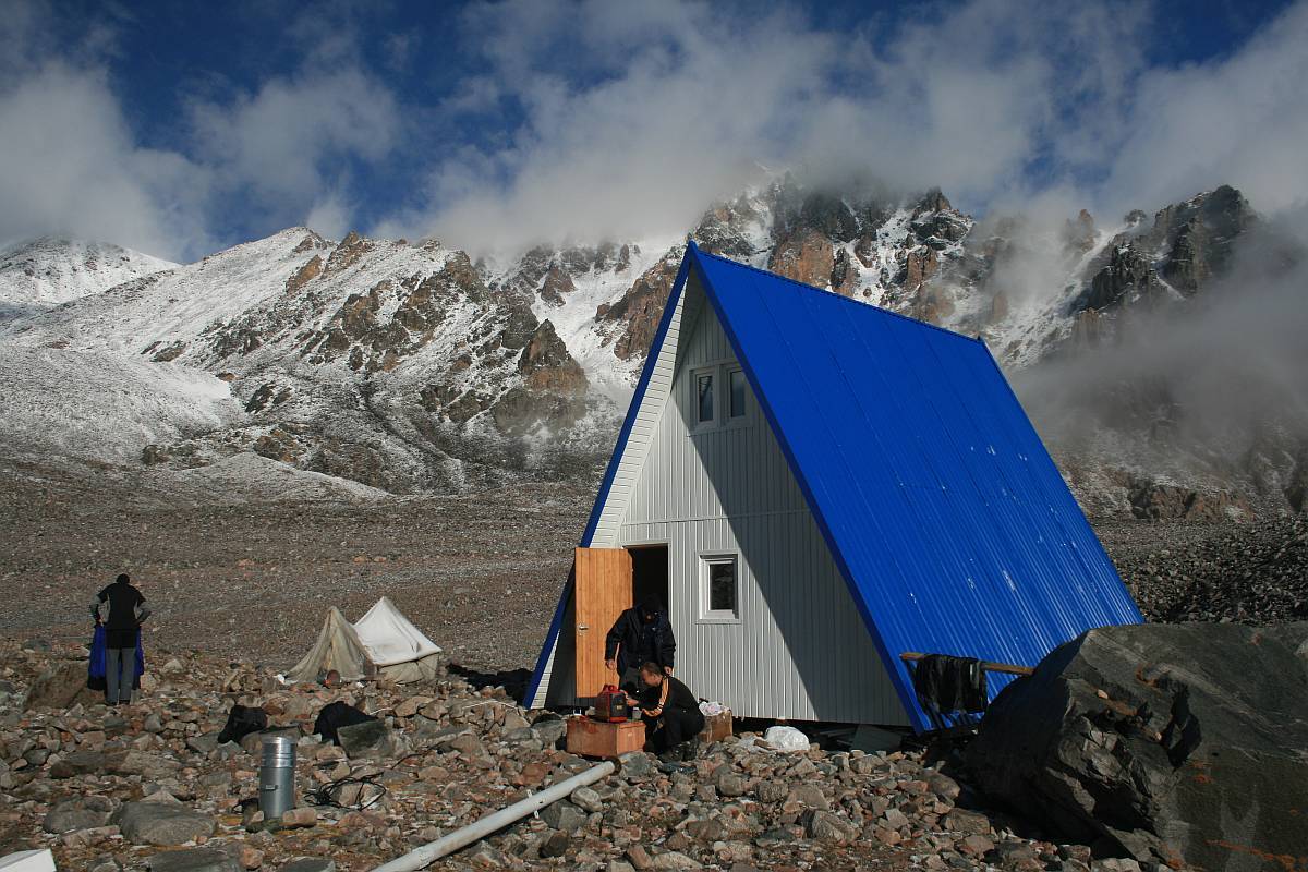
Once the material was delivered to the construction site, the building of the research station began immediately. The erection of the station was undertaken under poor weather conditions with frequent rain and snow. The building team must be congratulated on their achievement under such challenging circumstances. The whole building was completed by the second half of July so that the interior could then be fitted out and furnished.
The furnishing and instrumentation of the station and modifications of the ground outside were in progress until the autumn of 2008. At the same time, the scientific equipment was gradually brought into operation and the research team began to fulfill the scheduled research program.
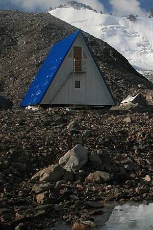
Building housing the station and its equipment
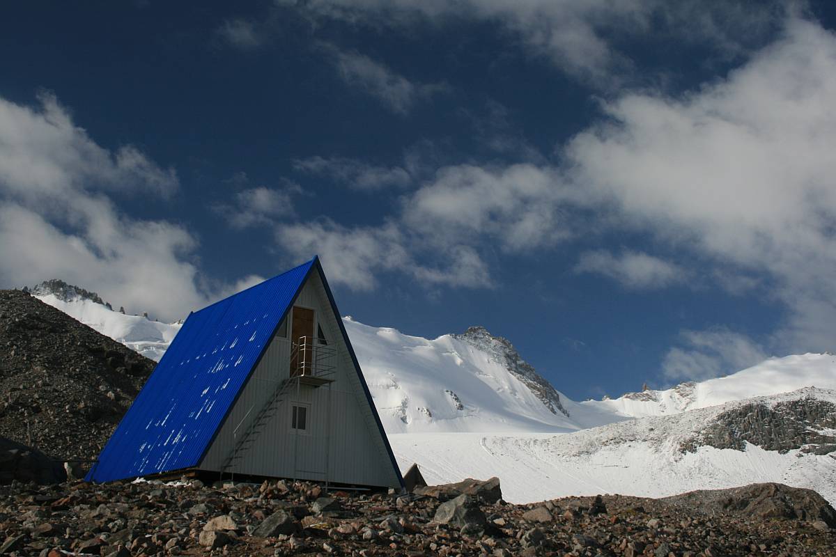
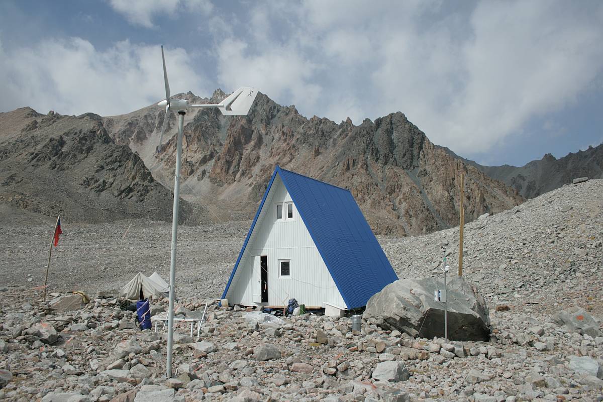
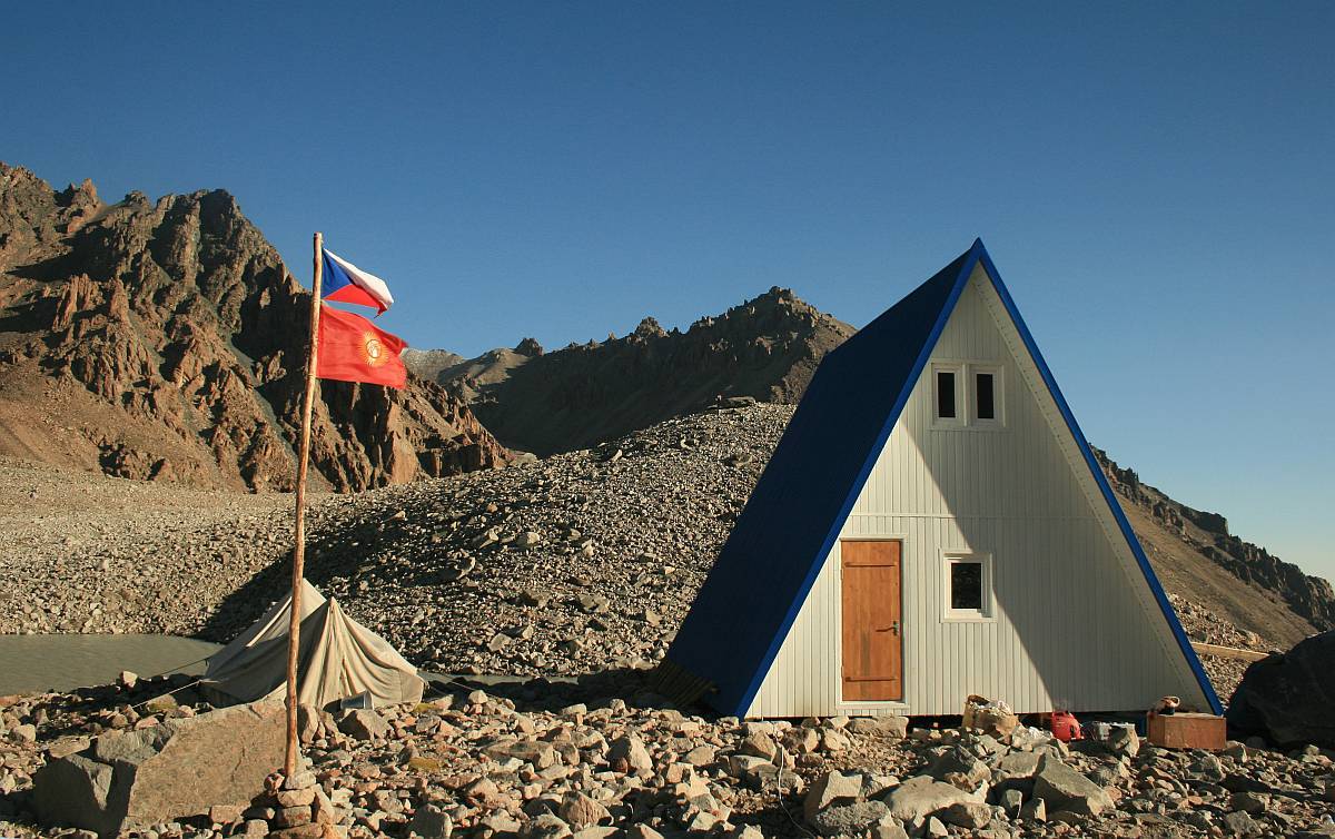
The station is constructed as an A frame with dimensions 6.5 x 7 m. Two rooms separated by a corridor occupy the ground floor. One serves as a bedroom and living room for the permanent crew, the other is a study and dining room. Two rooms in the attic serve as bedrooms, each for three people.
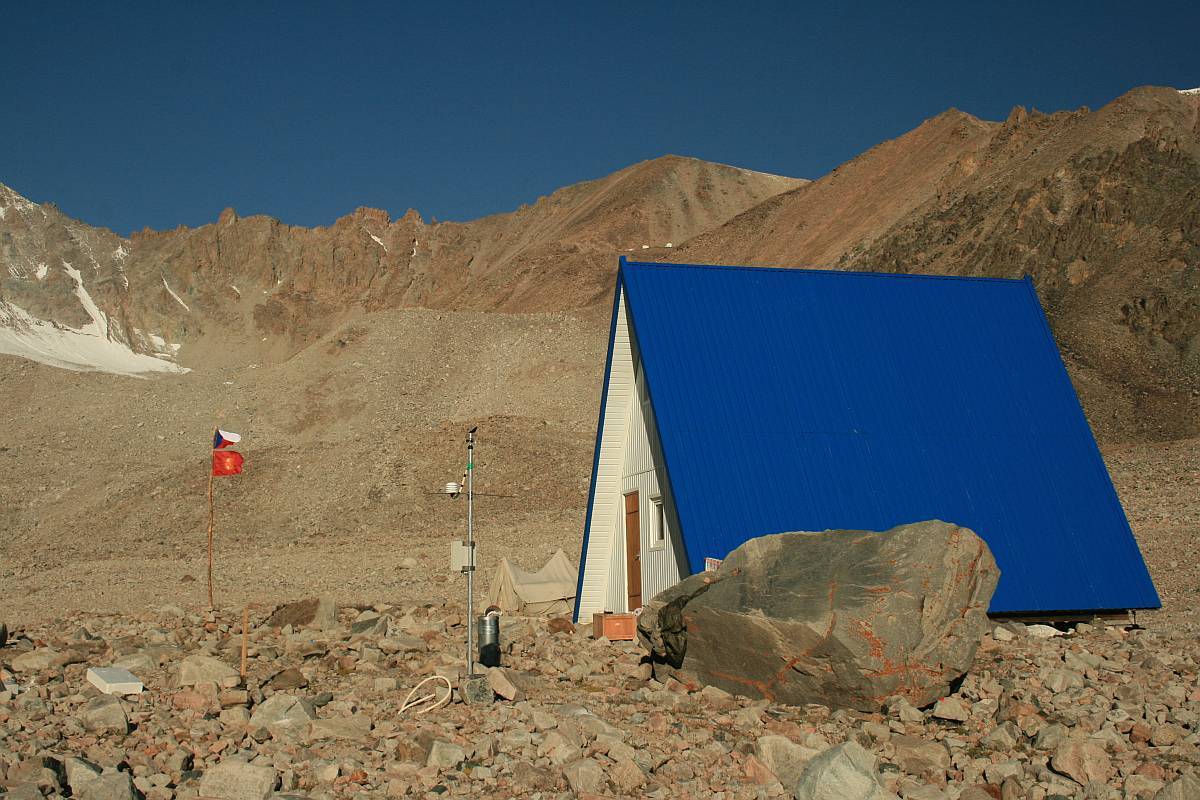
The main electric energy supply is provided by a small wind turbine with an output of 1 500 W (supplied by the Czech company MG plast). A solar panel (Solartec Co. Ltd.) and two petrol generators are complementary sources of energy. The electric current from these sources is transformed to 220 V and distributed into electrical appliances. Heating is provided through infrared heaters in the ceilings (supplier: Infratopení Co. – www.infravytapeni.cz), in the crew bedroom there are 2 x 300 W heaters, in the study there is 1 x 300 W heater. Illumination is provided by 1.5 W LED light bulbs. The rooms are carefully thermally insulated and largely separated from the outside walls by a corridor. It is a low-energy building that can remain in operation even during the winter months. Monitoring instruments are deployed in the environs of the station. Some of them are fully automated in continuous operation, others make measurements at regular intervals.
|
Scientific program of the research station
a. Monitoring of hazardous lakes
The state of all lakes and changes in their size, shape and water level are continuously monitored. All changes in morphology of moraine dams, rifts, landslides, collapses, etc. are also monitored. In case of emergency the relevant institutions will be informed immediately (Management of the National Park, Ministry of Contingent Situations.)
b. Meteorological observations
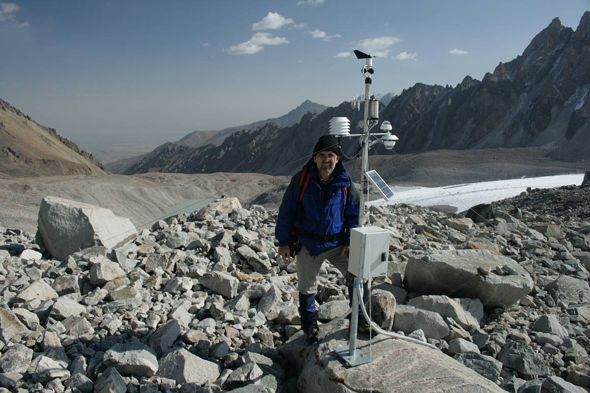
Two complete meteorological stations (supplied by Fiedler-Mágr, České Budějovice). were installed at the site as part of the program of climate monitoring. One of them is situated near the building. It automatically records temperature, atmospheric pressure and humidity, wind speed and direction and soil temperature. In addition there are analogue thermometers and a rain gauge. The other fully automated meteorological station was installed on a ridge above the glacier at an elevation of 3 830 m above sea level. It records 11 parameters (temperature, pressure and humidity of air, precipitation, global radiation, albedo, speed and direction of wind, and soil temperature at three depth horizons). All parameters are recorded and stored at ten-minute intervals. The recorded data are transferred twice a day via GMS to an Internet server. In addition these data are also stored in a datalogger and can be downloaded to a PC. At present, this research station is the highest meteorological station in Kyrgyzstan and the whole of the Tien Shan mountain range. The data obtained will be used for comparative studies of glacier development and all associated phenomena responsible for natural hazards.
c. Hydrological studies
Hydrological measurements are essential when monitoring the development of lakes and their inflows and outflows. A water level pressure meter that automatically records fluctuations of the water level has been installed in the upper lake. Staff gauges are installed at the other lakes. Current meters are installed in all accessible streams to measure water discharges at regular intervals
d. Glaciological studies
This investigation is designed to monitor all phenomena related to glacier retreat. The snout of glacier has been precisely surveyed and geodetic marks were installed at the beginning of works. The geomorphological map of the area was revised to incorporate all changes marking the retreat of the glacier. Staff gauges will be installed to measure the thickness of the snow cover. A grid of dataloggers has been installed to measure the temperature of the permafrost.
e. Other studies
In addition to the investigations planned within the scope of the project, the station is open to Kyrgyz researchers and scientists from other countries undertaking studies of the atmosphere, the content of greenhouse gases, mountain botany, etc. The Academy of Sciences of the Kyrgyz Republic, the Russian-Kyrgyz Slavic University, the Institute of Water Issues, the Czech-German CAIAG (Central-Asian Institute of Applied Geosciences) have already shown interest in using the research station, and negotiations with institutions from other countries are in progress.