


COURSE OF WORK 2007-2008
Investigations undertaken so far
A map depicting the scope of works undertaken in 2007 and 2008
Works carried out in 2007
The following objectives scheduled for the year 2007 were fulfilled:
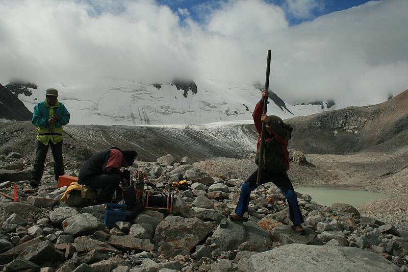
Investigations undertaken at model localities
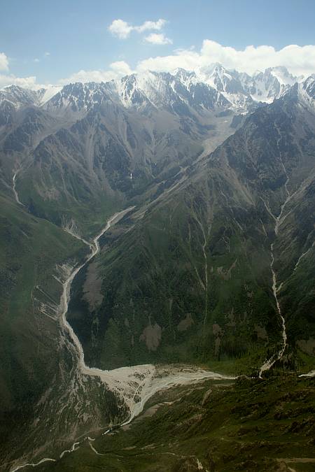
However, the central part of the National Park is endangered by a number of types of natural phenomena posing risk. The most frequent are debris avalanches originating in summit parts due to torrential rains or sudden failures of dammed alpine lakes. It is worth to note that several bursts of water from alpine lakes occurred in the past and some of them have had catastrophic impacts.
The third locality includes the moraine of the Testor glacier where several moraine and thermokarst lakes occur. Lakes failures causing damage were recorded in 1953, 1968 and 1988.
Because of increasing number of people visiting the National Park and land-use planning for the development of local infrastructure it is anticipated that the future lake failure may cause much more damage than earlier bursts of water. Consequently, the area should be studied in detail and monitored in long term.
Detailed geomorphological and hydrological studies of most endangered valleys are carried out within the scope of the project This investigation will result in compilation of maps of natural hazards on which zones corresponding to the degree of danger will be depicted and demarcated. These maps will serve to the Park management to issue restrictions for the visitors to avoid the most endangered localities and sites and for realistic land-use planning for the development of adequate infrastructure that is scheduled to be materialized in future.
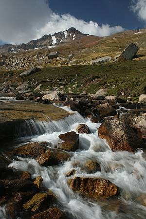
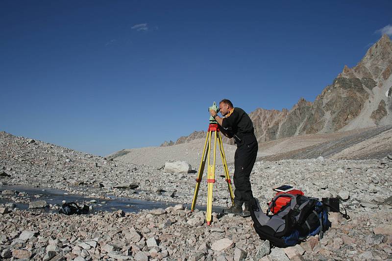
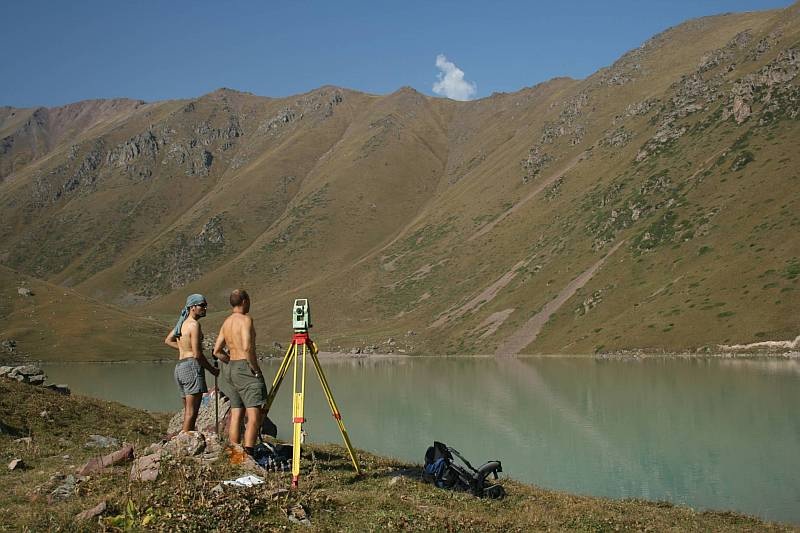
The lower part of the Ak-Say valley has been surveyed and longitudinal and transversal profiles demarcated to enable compilation of detailed maps depicting the course and path of flood waters.
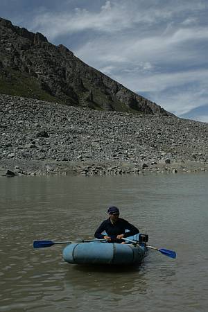
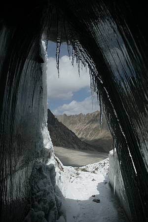
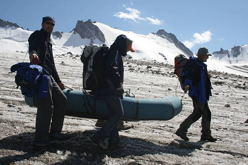
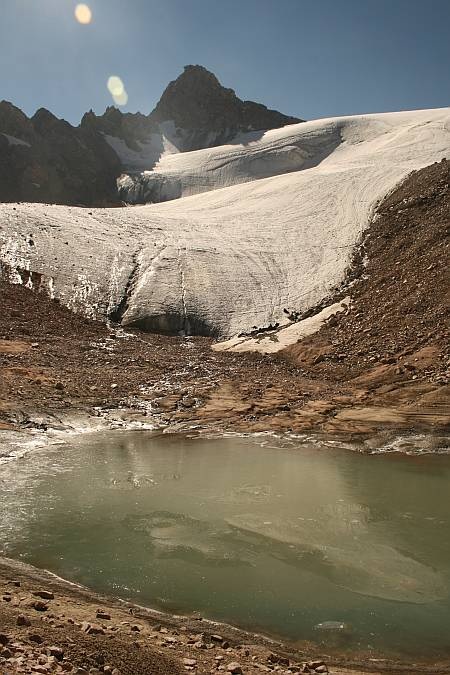
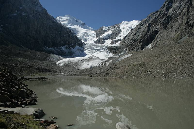
Detailed studies were carried out at the Adygine locality which involved surveying of the glacier snout, surveying and bathymetry of newly originating lakes, including the Lower Adygine lake and surveying of profiles with fixed points placed on the glacier body.
It is a type of lake dammed by an old moraine and by a landslide. It lies at an altitude of 2 715 m a.s.l. and its actual volume amounts to 1,830,000 m3. The lake is drained through underground channels in the dam but if completely filled the water it begins to spill over the lowest part of the dam’s crest. Long channel due to erosion formed on the outer wall of the dam. It may become deeper during water overspills. The dam can be disturbed by this channel as well as by change in the regime of underground channels which may result in a water burst from failed lake dam that would have catastrophic impact because of the large volume of water in the lake and the valley gradient.
It is realistic to assume that due to the climate change the ice buried in moraine and on the glacier will begin to thawing which together with more frequent torrential rains will result in the formation of debris avalanches.
It is to be pointed out that the bottom part of the Koltor valley and the adjacent Kegety valley are relatively densely populated. Permanent settlements occur in lower parts of the valley and at along its mouth into the Chuy plain. Immediate vicinity of the river is used as camping sites. An unpaved road goes along the river which is crossed by several bridges. An elevated water piping also follows the river course.The whole of this infrastructure is endangered by lake failure and the flood waters would strike the adjacent part of the Chuy plain that is densely populated and intensely cultivated.
The Koltor lake has been monitored for long time and numerous reports elaborated in the course of the last 40 years, including maps and photographic documentation, are available.
Monitoring of the lake, due to the increasing level of dangerousness, belongs among the project high priorities. The lake has been monitored during the project execution and various studies are in progress intended to provide data on the development of the lake basin, state of the lake dam and finally the compilation of a map defining the degree of risks.
The Cherkanak valley in the area of the Talas mountain range in the western sector of Kyrgyzstan was chosen for new investigations in 2007. A number of lakes considered to be at risk occur in the upper parts of side valleys leading in the Cherkanak valley. Two of them failed in the past. The Dzhalpaktor 1 lake in the valley is assumed to be most dangerous. A dam burst which in 1993 brought in the Cherkanak river valley ca 1 mill. m3 of debris avalanche material resulted in catastrophic event and the Ak-Say village was stricken by high flood waters. Another lake failure of lesser intensity occurred in 1997.
The development of lakes was not monitored in the last years and since some water reservoirs and irrigation channels were constructed in lower part of the valley there exists a justified anxiety about possible failure of some dams.
The last failure of the Dzhalpaktor 1 lake was followed by a few other bursts of water but of no catastrophic dimensions because local herdsmen were aware that such event may happen. One failure occurred in 1999, and another one was recorded in 2003. During our visit to the lake on August 27, 2007, the lake bottom was almost dry. However, some traces after the last burst of water which happened through underground channels could have been observed. Because of certain periodicity of lake dam bursts it may be worth to monitor the lake more frequently and in the case of its water level approaching the maximum the population living in the valley should be warned ahead of possible danger.
| the initial lake | area | 1,32 ha |
| perimeter | 457 m | |
| length | 166 m | |
| width | 109 m | |
| lake’s relic | area | 1580 m2 |
| volume | 880 m3 | |
| max. depth | 1,5 m | |
| medium depth | 1,56 m | |
| length | 60 m | |
| width | 33 m |
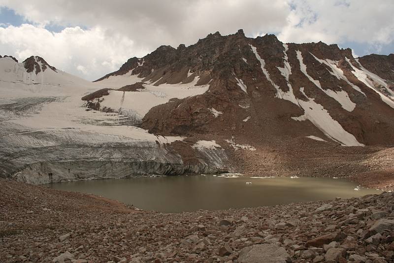
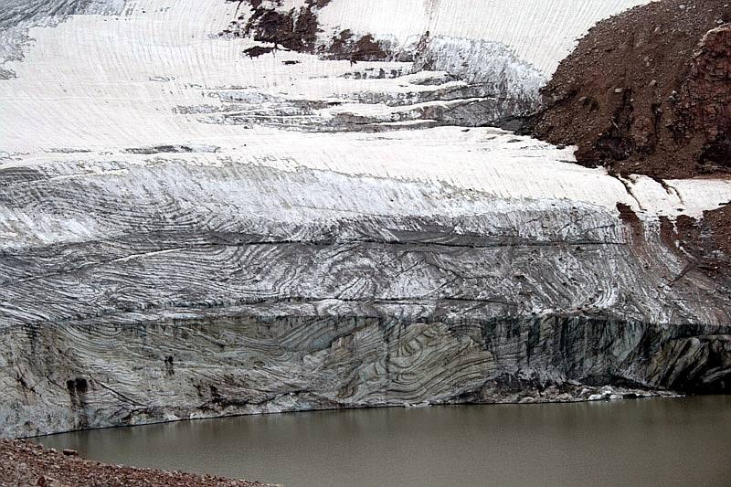
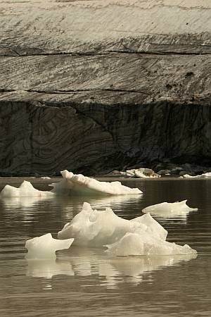
lies in the valley closure being the largest one of all the lakes in the valley. It can be classified as a proglacial lake when the glacier snout ends straight in the lake. The lake is dammed with moraine-glacier complex. A small thermokarst lake developed in part of the dam adjacent to the lake. This thermokarst lake, judging from traces of abrasion, is thought to have been larger forming a bight of big lake. The difference between the present water level in the thermokarst lake and the uppermost preserved trace attains 1.5 m. The discharge of this lake and perhaps even part of the large lake possibly in early summer of 2007 is likely to have occurred through an underground inlet of huge dimensions (a cave ca 1.5 m high and ca 5 m wide).
Bathymetric mapping of the Cherkanak lake was carried out within field operations, including planimetric survey of emptied thermokarst lake. The following morphometric parameters were established:
| area | 6,69 hectares |
| volume | 603 tis. m3 |
| max. depth | 18,1 m |
| medium depth | 9,01 m |
| perimeter | 1024 m |
| length | 345 m |
| width | 239 m |
Works undertaken in 2008
Works undertaken at model localit
Geophysical survey was the major activity in 2008. The measurements were undertaken by two teams, specifically by the Czech G impuls Company Ltd. Prague, and by the Kytgyz company Geopribor. The Czech team carried out geo-electric measurements using resistivity tomography supplemented by the DEMP and spontaneous polarization methods, while the Kyrgyz team applied the VES method and seismic measurements. The measurements were made on roughly the same profiles as those measured three years ago in order to establish changes in the lake dam. These profiles were supplemented by a longitudinal profile running over the dam crest and then along erosion channel originated on the outer wall of the dam.
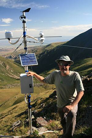
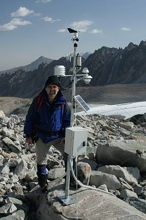
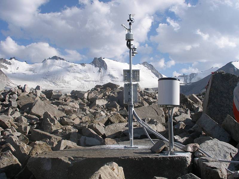
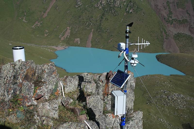
In addition to these works, a complete meteorological station was installed on nearby mountain crest at an altitude of 3070 m a.s.l. and a pressure sensor with datalogger measuring the water level was placed on the lake bottom near the dam.
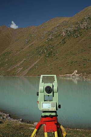
Geodetic works were focused on completing the measurements in the upper part of the Ak-Say valley and to start measurements in the Adygine valley.
Geophysical survey was also carried out at this locality using similar spectrum of methods as that applied at the Koltor lake dam. The profiles were laid over the dam top of the Adygine large lake and over the dam of newly originating lake below the glacier snout. They were intended to investigate the dam structure and the length of rock bar underneath the moraine part of the dam. It was tentatively established that part of the dam is formed by moraine filled with ice which increases the risk of water burst in both lakes.
Two meteorological stations were installed in the area. One fully automated at the glacier level at an altitude of 3 780 m a.s.l. (presently the highest station in Kyrgyzstan) and the other one semi-automated supplemented with an analogue rain gauge and thermometers was placed near the research station building at the lake level. Data on the water level and temperature of permafrost were withdrawn from dataloggers. The glacier edge and the areal extent of lakes originating below its snout were surveyed. These measurements showed that the glacier retreated on average by 10 m during one year.
The Issykkul region in the eastern Kyrgyzstan was chosen for field reconnaissance and investigation. Numerous glacial lakes occur in the Terskey Ala-Too mountain range and some of them were classified as to belong among the 1st and 2nd category of hazardousness.
The Chong Kyzyl-Su valley
This valley was selected for basic research because several lakes lie in its uppermost parts and were considered to be potentially at risk of failures. The last information about their state came from helicopter low flight over these lakes in 2002. Besides that a meteorological and research station operated in the valley in the past. The station is currently renovated by the Institute of Water Management. Consequently, there is fair chance for carrying out subsequent monitoring of parameters and phenomena measured and studied earlier. The Kara-Batkak and Savator lakes were explored in detail and field reconnaissance and assessment of their conditions with regard to glacier retreat were undertaken. Draining of all the monitored lakes was found presently stable and the retreat of glaciers in this part of the Terskey mountain range was found much slower relative to other investigated areas of Kyrgyzstan.
Burst of water from the Zyndan lake
Burst of water from a lake in the Zyndan valley located on northern slopes of the Terskey Ala-too mountain range occurred on July 24, 2008. The failure resulted in debris avalanche which damaged several buildings, pastures and swept away 300 m long section of an unpaved road. A car crashed in place of swept away road and three people died in this accident. A few heads of cattle were also killed. The flood waters damaged water reservoirs and water piping in lower parts of the valley. Because of interruption of fresh water inflow into large capacity fish farm ca 1 300 000 small rainbow trout ready for transfer into the Issyk-Kul lake perished.
Messrs S.Jerochin and M.Černý, on request of the Ministry of Emergency Situations, participated in a mission to the locality organized two days after the burst of water to do a reconnaissance and preliminary assessment of damage.
The project scheme during the subsequent expedition to the Issykkul region was modified enabling to revisit the locality and to document the extent of the water burst. A lake from which the water was drained was found in summit part of the valley at an elevation of 3 800 m a.s.l. A few profiles were surveyed across the river bed and the initial lake shoreline. Once the satellite imagery will be available a map depicting the lake failure will be constructed. The preliminary results show that ca 470 000 m3 of water with ca 15 m3 discharge in the place of water outburst and as much as 70 m3 in the debris avalanche were drained from the lake.
The Petrov lake
As each year since 2005, an appropriate attention was paid to the Petrov lake, which is the largest glacial-moraine lake in the Tian Shan mountain range, and which belongs for long time to lakes at high risk.
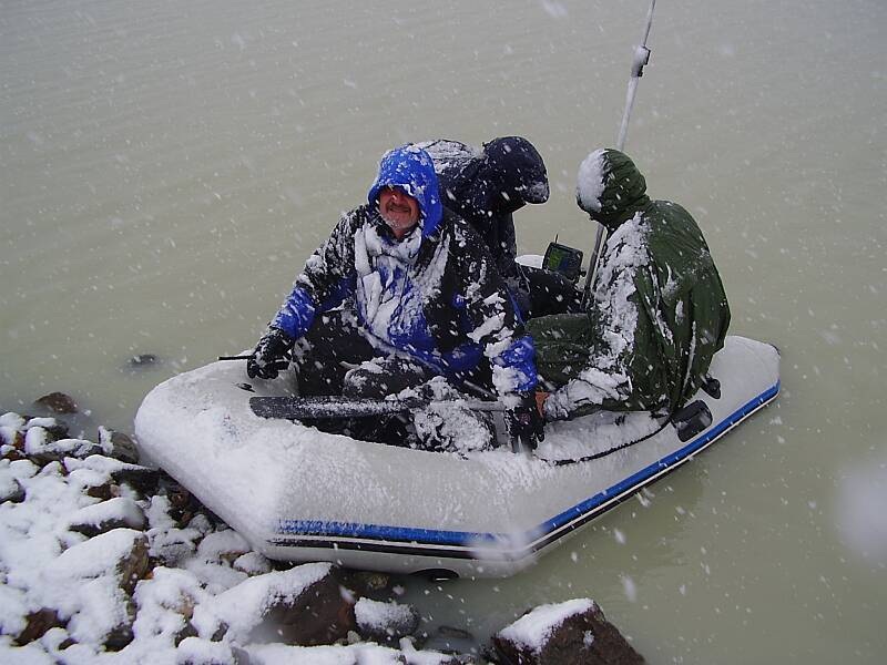
The lake dam was inspected and recurrent bathymetry was made in Blue bay, including the deepest part of the lake, and the glacier snout was also surveyed. The so-called Blue bay, which is considered to be the site at major risk, was found larger by 0.4 hectare during the last two years and the glacier retreated by ca 100 m. Some changes in the inner part of the dam and in the thermokarst lakes were also observed.
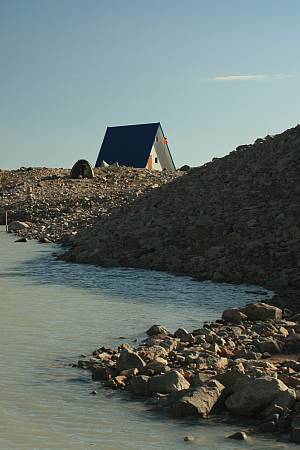
A permanent monitoring and research station was constructed during the field season in 2008 at the Adygine locality. Special chapter is devoted to this station on web page (ADYGINE STATION) and special web pages on the address www.adygine.com dealing with the subject.