
MANAGEMENT OF WATER SOURCES IN THE SOUTHERN GOBI, MONGOLIA
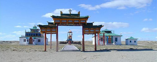
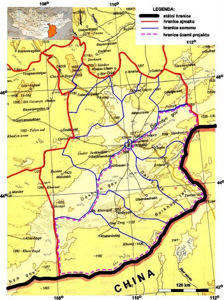
SUSTAINABLE DEVELOPMENT OF WATER RESOURCES, WATER MANAGEMENT AND THE FIGHT AGAINST DESERTIFICATION OF THE DORNOGOBI REGION IN THE SOUTH-EASTERN PART OF MONGOLIA
Administrative body: Ministry of the Environment of the Czech Republic
Technical supervisor: RNDr. Martin Hrubeš
Contractor: GEOMIN družstvo, Jihlava
Project manager: RNDr. Vilém Fürych
Cooperating organizations: SIHAYA s.r.o. Brno, Mgr. Viktor Valtr
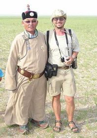
Partner organization in Mongolia:Ministry of Food Supplies and Agriculture
Cooperating organizations in Mongolia: USJUULAGCH Sainshand
The project is partly financed from the state budget of the Czech Republic via the Official Development Assistance Program of the Czech Republic. The major part of the finance allocated for technical work is reimbursed by the Mongolian counterpart
Schedule of implementation of the project: the project was carried out during the years 2003 - 2006
The aim of the project was to ensure effective water management and renewal of individual water resources in the southern part of the Dornogobi region (Aimak). The existing conditions force the herdsmen and their herds to concentrate in areas with a limited number of wells. This leads to intense grazing of steppe in the environs, as a result of which wind erosion of the soil and progressive desertification is taking place. Increasing the number of available sources of water should enable herds to be dispersed over a larger area of pasture and thus reduce the impact of human activities in the region.
In 2003, the project was initiated by a detailed study of available information about natural conditions in the area under consideration, and about its history of habitation and agricultural use. It was discovered that, with the exception of the town of Zamyn Uud and its environs, only between 60 – 80 % of the pastures are being exploited, so the productive capacity of the local steppes was not being exceeded.
It was immediately evident that the reason for overgrazing of steppes in certain areas is not the excessive number of animals in the herds but the small number of functioning wells around which the herds have inevitably been concentrated, placing pressure on the local pasture.
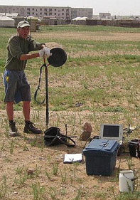
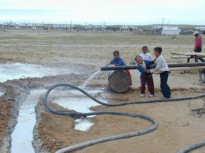
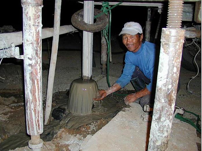
In 2003, some geophysical measurements were also made in the urban areas of Urgun, Ulaan Uul and Zamyn Uud. In Urgun this work was followed by drilling and a well with 1.5 l.s-1 yield has been completed.
More geophysical exploration was undertaken in 2004 in the SW part of the project area at Khatanbulag somon (district) where the potential for new pastures was recognized. Here, geophysical measurements were carried out at 6 sites and suitable locations were identified where exploration boreholes could be drilled in 2005.
Geophysical measurements were also made in the environs of the town of Sainshand, the administrative center of the Dornogobi aimak (region). Geophysical exploration was followed by drilling. Three wells were completed in the vicinity of Sainshand town with yields varying between 1 and 3.6 l.s-1. Another extraction borehole with a yield of 1,0 l.s-1 was drilled in the small town of Ulaan Uul, the center of the Erdene somon. In addition, three existing wells in the Khatanbulag somon having a combined yield of 6,0 l.s-1 were renovated. Drilling was also undertaken in the town of Zamyn Uud, but with no success.
Geophysical exploration at two localities in the Khatanbulag (Devseg and Shuvuun) somon was scheduled to be completed in 2005 and supplementary measurements were made at Zamyn Uud. Drilling was carried out at sites where geophysical measurements and exploration work were undertaken in 2004. A new borehole was drilled at Zamyn Uud . Altogether 5 new boreholes were drilled to depths reaching a maximum of 150 m and the yields obtained were between 0.3 – 1.6 l.s-1.
It was immediately evident that the reason for overgrazing of steppes in certain areas is not the excessive number of animals in the herds but the small number of functioning wells around which the herds have inevitably been concentrated, placing pressure on the local pasture.
In 2003, some geophysical measurements were also made in the urban areas of Urgun, Ulaan Uul and Zamyn Uud. In Urgun this work was followed by drilling and a well with 1.5 l.s-1 yield has been completed.
More geophysical exploration was undertaken in 2004 in the SW part of the project area at Khatanbulag somon (district) where the potential for new pastures was recognized. Here, geophysical measurements were carried out at 6 sites and suitable locations were identified where exploration boreholes could be drilled in 2005.
Geophysical measurements were also made in the environs of the town of Sainshand, the administrative center of the Dornogobi aimak (region). Geophysical exploration was followed by drilling. Three wells were completed in the vicinity of Sainshand town with yields varying between 1 and 3.6 l.s-1. Another extraction borehole with a yield of 1,0 l.s-1 was drilled in the small town of Ulaan Uul, the center of the Erdene somon. In addition, three existing wells in the Khatanbulag somon having a combined yield of 6,0 l.s-1 were renovated. Drilling was also undertaken in the town of Zamyn Uud, but with no success.
Geophysical exploration at two localities in the Khatanbulag (Devseg and Shuvuun) somon was scheduled to be completed in 2005 and supplementary measurements were made at Zamyn Uud. Drilling was carried out at sites where geophysical measurements and exploration work were undertaken in 2004. A new borehole was drilled at Zamyn Uud . Altogether 5 new boreholes were drilled to depths reaching a maximum of 150 m and the yields obtained were between 0.3 – 1.6 l.s-1.
The project will be concluded in 2006. Two more boreholes are scheduled to be drilled, and five wells will be reconstructed. Comprehensive recommendations for efficient exploitation of local water resources and their management will be submitted
AIM OF THE PROJECT
The project is designed to renew the supply of water (potable water, industrial water and water for animals) for the southern half of the Dornogobi aimak (region). The intention is to ensure further development of the region using the new wells and renovated water supplies completed during the project. The results of the investigation of the history of pastoral activity in the area will be used to support the traditional methods of farming and husbandry used by the local population. The ultimate aim is to ensure a sustainable pattern of land use and reduce the impact of human activities that are causing progressive desertification along the northern edge of the Gobi.
The chief objective of the project is to assist Mongolia by undertaking hydrogeological work that will enable regeneration of water resources and their management so that:
- the impact of human activities leading to progressive desertification in the Dornogobi aimak will be minimized,
- traditional methods of extensive farming will be sustained,
- further development of urban centers will be possible, in particular along the important railroad from Ulaan Baatar to Beijing, and
- industrial development in the region can be facilitated (e.g., mining for feldspars).
Close co-operation with state enterprises in the Dornogobi aimak and in the whole of southern Mongolia will enable Mongolian specialists to be trained in modern methods of hydrogeological surveying and to understand and measure the hydrodynamic parameters of tapped aquifers and their contained groundwaters so that appropriate conditions for their exploitation and management can be established.