
SOURCES OF CONTAMINATION IN THE AREA OF INTEREST
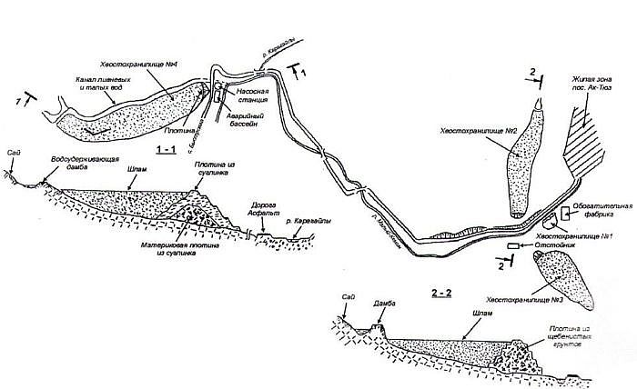
Settling pond No.1
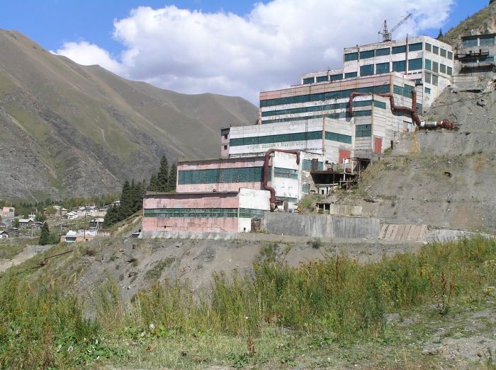
The oldest settling pond is No.1 located directly below the concentrator. A total of 370 000 cu. m of tailings were deposited in this tailings pond during the period from 1942 to 1955. These tailings contain a high proportion of REE, Th and heavy metals. A quantity of fine-grained REE-Th concentrate is currently exposed on the surface of the settling pond and is not secured at all. This concentrate could not been sold on the market once the mine was closed. The concentrate stored in this way is obviously exposed to aeolian erosion and may affect the local environment detrimentally. The face of the dam confining the tailings is broken by erosion and poses a further danger. The tailings are regularly exposed to atmospheric precipitation and due to the action of gravity can be washed down into the river Kichi-Kemin. The radiation measured at the foot of the dam attains as much as 150 uR/hr. Analyses of samples taken from the settling pond showed high concentrations of Pb (maximum 9 710 ppm), Zn (6 240 ppm), Cu (1 722 ppm), Mo (252 ppm), As (419 ppm) and Be (55 ppm). Significant contents of Cd (15 ppm), W (158 ppm) and Y (314 ppm) were also measured.
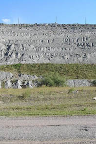
Settling pond No.2
has been constructed in a tributary valley on the right bank of the Kichi-Kemin river ca 2 km below the village of Ak-Tjuz. The tailings pond was in operation during the years 1954 – 1972. The volume of tailings accumulated by the year 1964 amounted to 1 050 000 cu. m. About 630 000 cu.m of radioactive waste leaked from the settling pond and were washed down into the Kichi-Kemin river valley following rupture of the dam. This ecological disaster was due to a combination of technical factors (imperfect stabilization and bad maintenance of the settling pond) and natural causes (earthquake and torrential rains). As follows from the published data, the tailings were washed down the river valley to a distance of ca 40 km. Radioactive sands with heavy metals reportedly flooded many houses in the villages of Ilichevskoie, Dzhany-Dzhol, Kichi-Kemin, Boroldoy, Mikhailovka and Enbek (the latter two settlements are in the territory of Kazakhstan). The thickness of the sand avalanche in the villages stricken was as much as 60 cm. The sediments were gradually removed and deposited in temporary settling ponds and covered by a protective layer. However, locally, some tailings were left in the river valley. For instance, a few thousand cubic meters were left behind directly on the river bank and adjacent inter-dumping ground south of Ak-Tjuz village near settling pond No.2. For some unspecified reason, these tailings were never removed. The ecological disaster described took place 40 years ago and is actually responsible for the current radiation and general environmental situation along the Kichi-Kemin river valley from Ak-Tjuz as far as the state border with Kazakhstan and probably even further downstream.
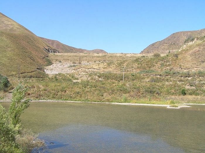
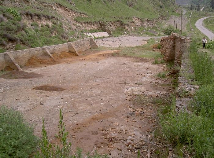
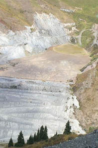
Settling pond No.3
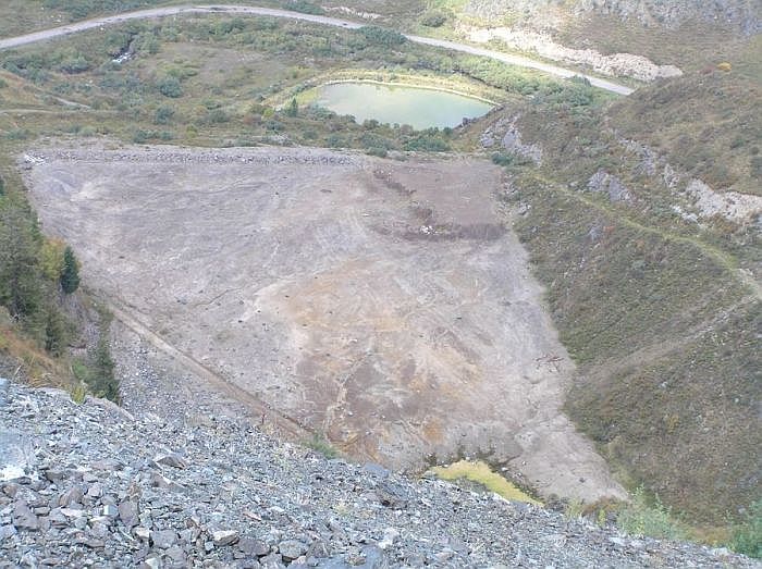
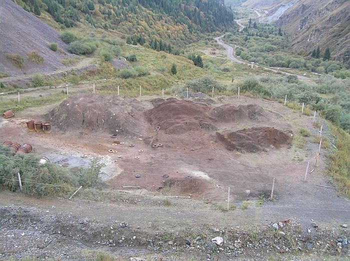
is situated in the valley on the left bank of the river Kichi-Kemin ca 2 km south of the village directly below the dumps of the Kutesai deposit. About 800 000 cu.m of tailings are deposited in this tailings pond in which some capacity is still left. A not exactly defined volume of Th-REE concentrate (a few hundreds to thousands of cu.m) were transported and deposited (without appropriate securing) in this tailings pond at the end of mining and ore dressing operations. The tailings pond was in operation during the years 1965 – 1978 and then, in 1979, it was given a protective covering but this has now been eroded by wind and atmospheric precipitation.
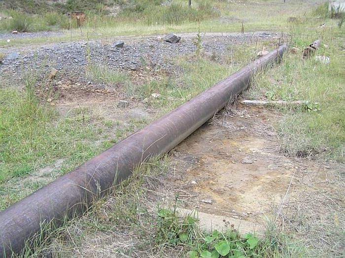
Settling pond No.4
is located ca 8 km below Ak-Tjuz in a tributary valley on the right bank of the Kichi-Kemin river. It contains 2 500 000 cu.m of tailings which were conveyed from the processing plant by a pipeline. Along this pipeline many traces of leaks of transported radioactive tailings can be observed. Detailed monitoring of the settling pond was carried out in 2000. The risk factors were defined and systematic measures were proposed to solve the situation (in co-operation with Finland).