


Project of development co-operation in 2007 - 2010

Development goal of the project
Definition of the target group
The immediate target groups:
Permanent inhabitants of mountain valleys. This group includes people living in permanent settlements in the lower tracts of valleys where houses, access roads, bridges and other facilities are endangered by bursting of lake dams.
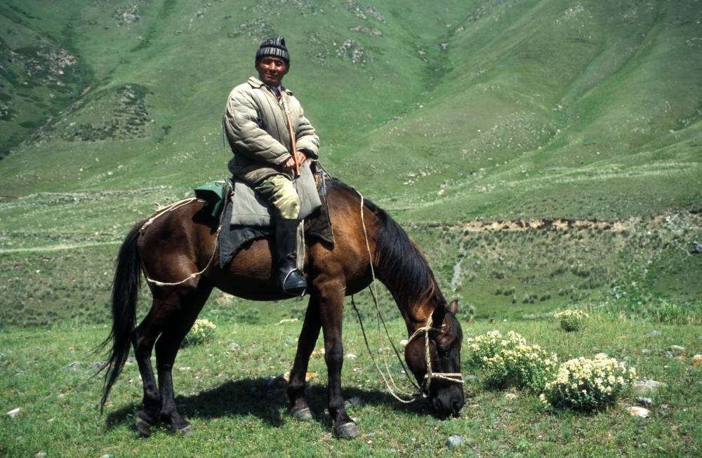
Herdsmen. They mostly exploit the middle and upper tracts of valleys and the immediate surroundings of streams for grazing herds of cattle, yaks, sheep and horses. They build their temporary shelters along streams and would be in direct danger if water bursts from an alpine lake.
Farmers. The lower tracts of mountain valleys, particularly where their mouths open into flat piedmont basins (Chuy, Talas, Issykul) are used for farming. Fields in the immediate neighborhood of streams are at risk when large bursts of water result in extensive flooding.
Tourists and alpinists. The increase in tourism is exposing a larger number of people in this category to the dangers caused by flooding in the alpine valleys.
Target groups benefiting from the project:
Gosgeolagentstvo. The state institution of ministerial status that is responsible for monitoring and investigating exogene natural phenomena and the dangers arising from them. It is the direct Kyrgyz counterpart in the co-operative project and will take over operation of the Adygine research station when the project is concluded.
Administrations. Central and regional authorities responsible for land-use planning and development in mountainous regions will make use of the project outputs for modifying and upgrading development plans in mountain valleys.
Entrepreneurial Sector. This includes all private companies tendering for state and private contracts, particularly those focused on the development of communications and tourist facilities in mountain valleys
Other institutions with interests in the Co-operative Development Project:
Kyrgyz Universities (The Russian-Kyrgyz Slavic University, the Polytechnical Institute and others) – will use the results of the project, including the facilities at the Adygine Research Station, for research purposes and educational activities.
Academy of Sciences of the Kyrgyz Republic – Individual scientists and research teams will actively participate in field operations and will also use the outputs of the project in their own investigations of climate, glaciation and associated hazardous phenomena.
Hydrometeorological Department – will co-operate in the assessment of climatic data and will also utilize observations from meteorological stations.
Institut vodnych problem a gidroenergetiki (Institute of water management and hydroenergy) – will co-operate in the project using the scientific results; it will also make available data and research facilities at its station in the Issykkul region for the purposes of the project.
Management of the Ala-Archa National Park – will utilize results of the project in its own development plans and to raise awareness of the issues related to glacial lakes and flood hazards among park visitors and users.
Goal aims of project
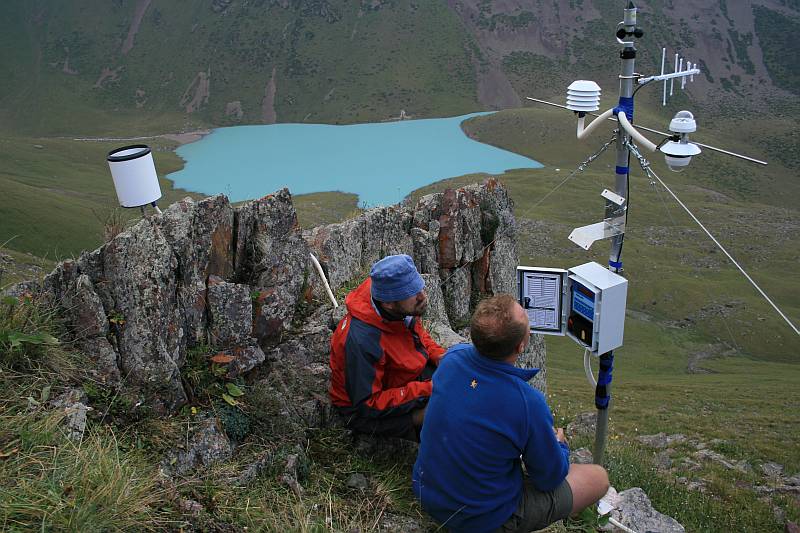
Goal aim No. 1: Assessment of hazardousness of particular lakes
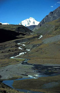
Lakes situated in distant areas of Kyrgyzsatn have been selected for the detailed study. Last time no information about development and actual state of these lakes is available. The result of our study is assessment of their extent, development, state-of the-art of dam and actual hazardousness. In the case when some risk will be identified, measurement to mitigate these risks are suggested. Object of interest represent lakes in Talas, Issyk-Kul and Osh area.
Goal aim No. 2: Risk analysis of selected endangered walleys
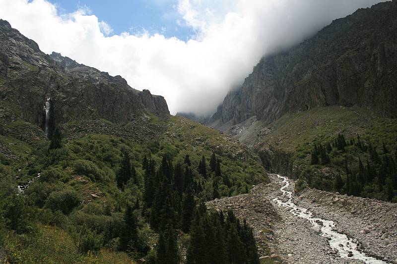
Detailed risk analysis have been carried out and dangerous and safety zones demarcated within two selected walleys, endangered by possible dam failure: Ala-Arča, situated in the National Parc of the same name, situated south of Bishkek and walley below Koltor lake. Ala-Arča walley, everyday destination of tohousands of Bishkek citizens and tourists is endangered by several lakes. In the case of big failure flood will reach lower parts of walley and adjacent part of Tchuj basin including Bishkek. In the case of Koltor walley and neighbouring Kageta, its infrastructure and part of Thchuj basin are endangered.
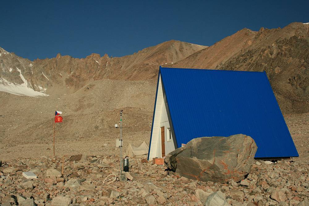
Goal aim No. 3: Building up of permanent research and monitoring station
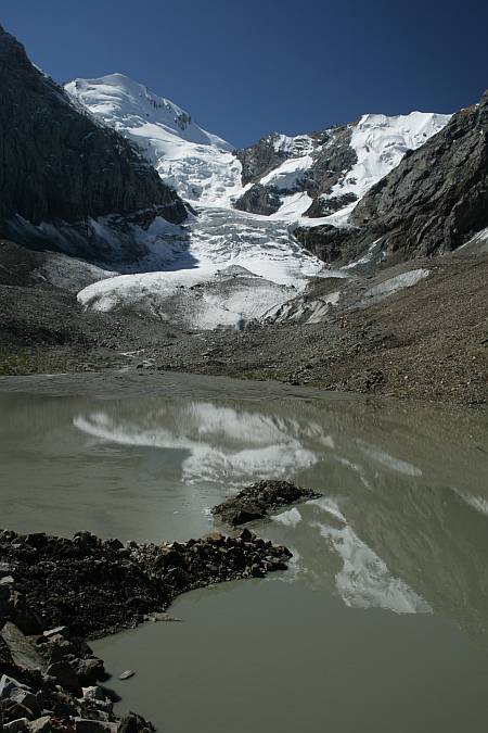
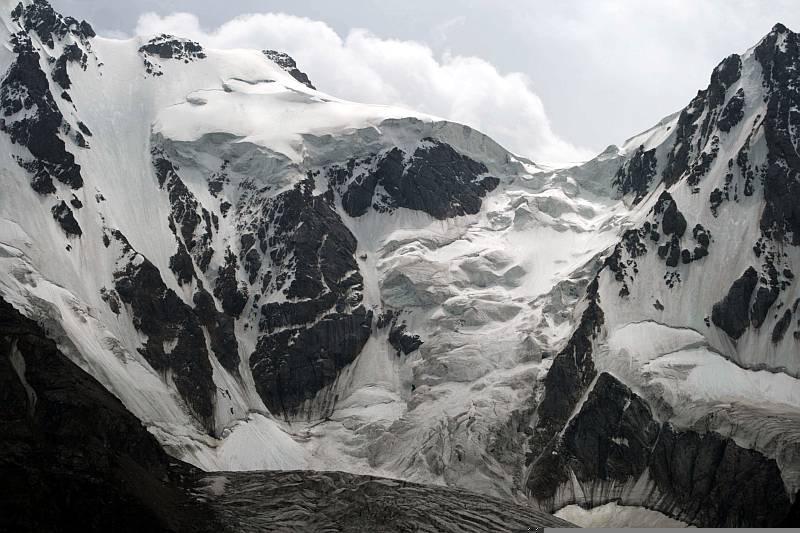
One of the main aims of project was building of permanent research station within glacier complex Adygine in the area of Ala-Arča. A few lakes occur at this locality, some of them being dangerous. Adigine glacier is quite quickly retreating. Small house have been built at locality, serving for yerly use. Two meteostation are now installed there together with next monitoring instruments. Station carries out programme aimed at study of glaciology, hydrogeology, climatology and monitoring of lakes development. Station will be available for Kyrgyz and foreign researches.
Goal aim No. 4: Security of Koltor lake dam
Erosion rill, made by recent landslide and extending after any new landslide due to overfalls have developed at the dam of Koltor lake. These overfalls are more and more frequent in recent years than before. There is danger that erosion rill breaks dam stability in so far as dam failure occurs. This, considering huge amount of water in lake (2 000 000 m3) could cause disaster of considerable dimensions.The basic ground shaping of erosion rill is financed by the project, reducing its next extension.
Goal aim No. 5: Predicting assessment of climate trends and development of lakes glaciationin the area of studied nountain ridges.
Archive as well as newly gathered data of montanous meteostations in Kyrgyzstan have been evaluated. New trends of climate development within individual montanous ridges of Tian-Shan have been studied together with their impact on glaciation and Alpine lakes.