


WATER SUPPLY OF ERDENET CITY

Technical supervisor: RNDr. Martin Hrubeš
Contractor: GEOMIN družstvo Jihlava
Project manager: Mgr. Antonín Kopřiva
Cooperating organizations :
G-IMPULS Praha spol. s.r.o. RNDr.Vojtěch Beneš
AQUA PROCON s.r.o. Brno, Ing.Petr Baránek
Partner organization in Mongolia: Ministry of Food and Agriculture, Municipality of the town of Erdenet
Cooperating organization in Mongolia: Erdenet Mining Corporation (GOK Erdenet)Schedule for implementation of the project: the project will be carried out during the years 2006-2008
Background information
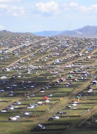
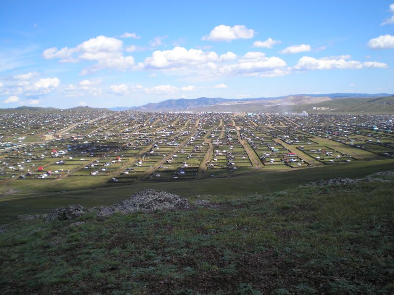
As the housing development in many of these towns and cities is almost non-existent (Erdenet) or the cost of relevant apartment is beyond financial resources of incoming people (Ulaanbaatar) there often grow large districts at the outskirts of towns and cities consisting mostly of single-floor family houses and yurts. Plots of land max. 1 000 m2 in size for construction of these houses are usually assigned by individual municipalities. The majority of such living quarters emerge more or less spontaneously regardless of urban planning and can be, with certain exaggeration, marked as slums.
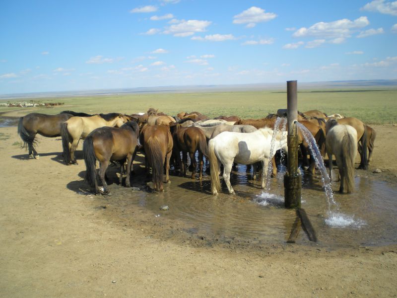
One of the most critical problems emerging and escalating with the growth of population in these quarters – the yurt settlements is the lack of potable water or great distance to accessible water resources. The water consumption in these slums exceeds ca 4 – 8 liters per person and day (on average only 4.6 liter per person a day), which is several times less than is the minimum volume recommended by the World Health Organization.
Ensuring sufficient number of water resources for slums of Mongolian towns is a necessary precondition for improvement of the standard of living and livelihood in general, and contemporaneously the improvement in sanitation situation of inhabitants living in these quarters.
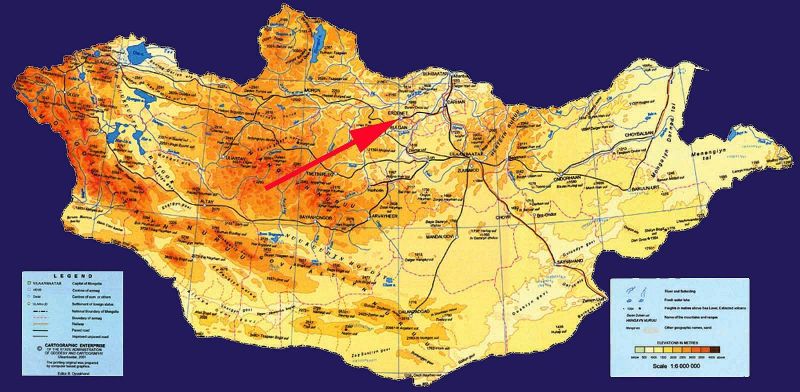
The history of the town of Erdenet goes back to the seventies of the last century when a large Cu-Mo deposit was discovered on the nearby elevation Erdenetyin Ovoo. The development of the deposit was connected not only with construction of mining and ore dressing facilities but also with arrival of manpower. The town lies in spring area of the river Erdenetuin gol at an elevation of 1 200 to 1 300 m above sea level, south of the watershed of two important Mongolian rivers the Selenge and the Orkhon.
The town of Erdenet can be divided in to the central part, yurt quarters and industrial zone. The central area consists of characteristic development of multistory panel apartment houses, offices and services. About 30 000 people are living in this part of the town, which has complete sanitary facilities and water supply.
The development program of the project is aimed at improvement of accessibility of the population to service and drinking water in the town of Erdenet and its outskirts. The project implementation and its outputs should ensure the supply of water for the poorest groups of the population that presently have no access to high quality drinking water and basic sanitary needs.
The project implementation is intended to ensure to maximum extent a permanent access of all social groups of population to potable water, even in the case of shutting down the Cu-Mo mine and closing the water supply connected with the mine.
The project objectives are defined as follows:
1. Construction of a system of water resources for the yurt settlement
2. Search for alternative water resources useable for water supply of the town once the Cu-Mo mine and the existing water main from the river Selenge are shut down
3. Construction of new wells for pasturage in the close environs of the townOutcomes of project:
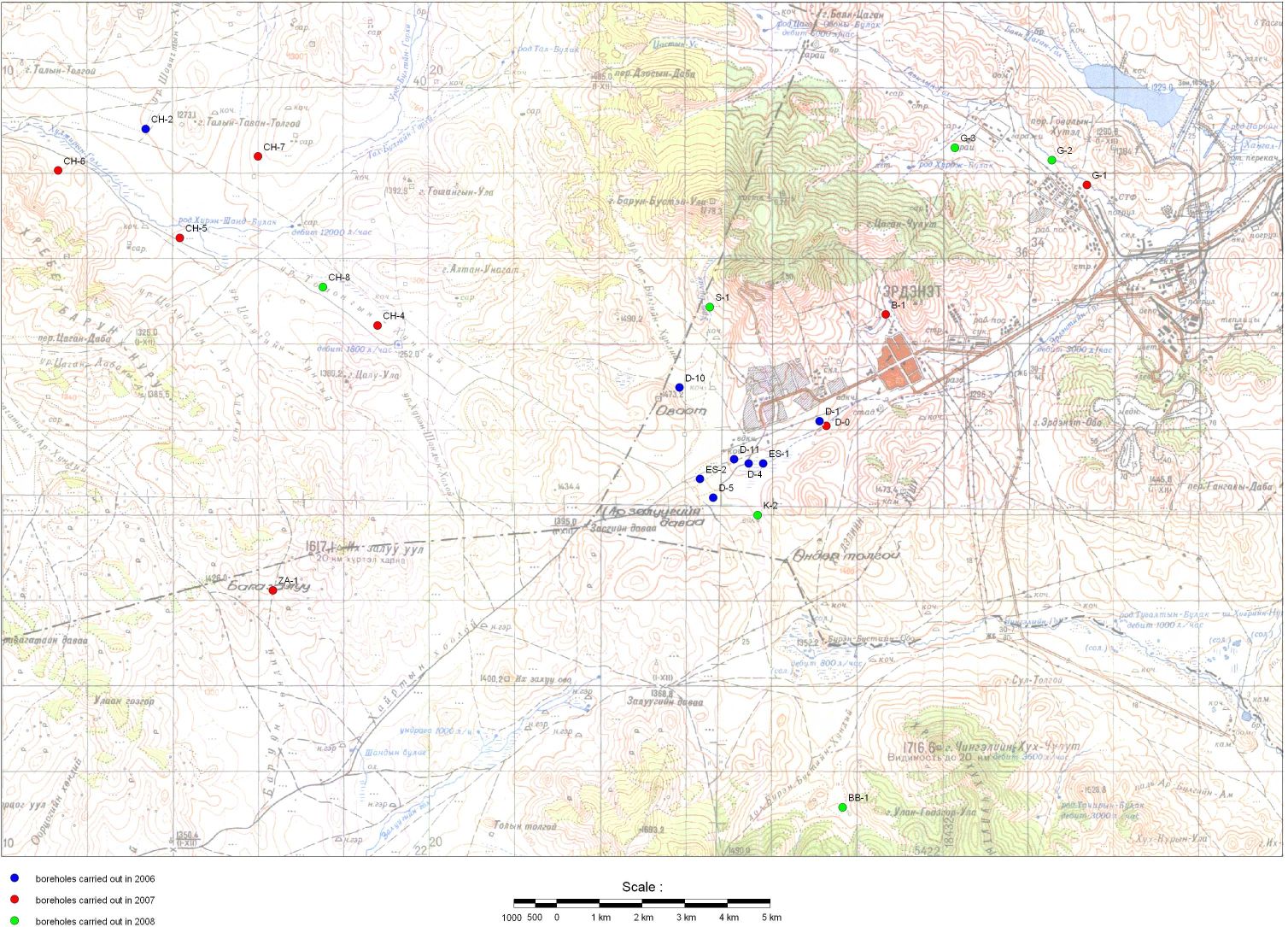
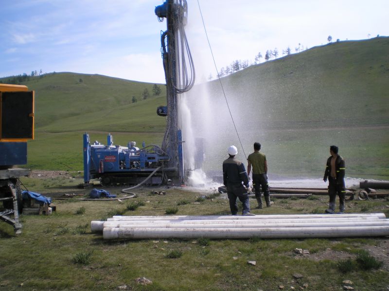
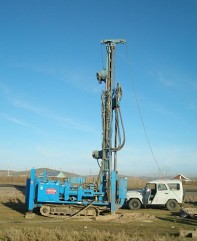
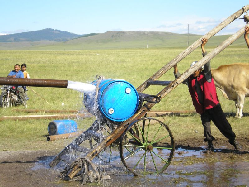
1. In total 22 hydrogeological abstract wells have been built within numerous localities at Erdenet city and its surroundings, these improving in notable degree watter supply of habitants by drinking water. Nine of 22 wells have been built in pasturelands in larger area of city (localities Chudjiriin, Zalugiin gol, Govilyn gol, Ar bulag, Buren bust) for the purposes of herdsmen and their herds as well as for the support of newly developing plant production. Remaining 13 wells have been deepened directly in Erdenet city or in it's close vicinity and serve for water supply of citizens. Target group is represented mainly by habitants of the largest western yurt living area – slum in Erdenet (Хоролоол) and yurt area at Govilyn gol locality. One well have been also made for water supply of Erdenet hospital. All wells of depth between 54 – 120 m were assessed on the basis of hydrodynamic tests as successful with usable yields 2,0 – 12,5 l.s-1.
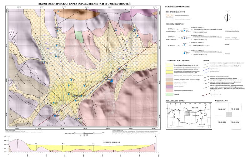
2. Hydrogeological map of area under study, representing one of outcomes of project have been compiled on the basis of archive data evaluation, interpretation of satellite images, available hydrogeological maps and clasasic hydrogeological mapping and terrain reconnaissance work. All recent and newly built hydrogeological bodies (springs and natural outflows of underground waters, digged wells, shallow drill holes, deep abstraction wells) as well as results of hydrogeological and geophysical exploration drillings (interpretation of tectonics and fault structures) and places favorable from hydrogeological viewpoint for deepening of further abstract wells have been proved by evidence in this map.
3. Creation of hydrogeological databassis and its implementation into Geographic Information System (GIS) represented the next outcome of project, serving as an important backgroud for needs of local authorities, especially for Erdenet city and Orkhon aimag authorities. Databasis structure have been created in Access (*.mdb) programme, comprising documentation of cca 200 hydrogeological, hydrological and further bodies (springs, wells, drillings, superficial streams and objects). Databasis is linked to functional layers of GIS, assembling mainly maps (topographical, geological, hydrogeological),satellite images and results of hydrogeological and geophysical survey. Databasis is made in such a way in order to be used operationally and continually completed and developed in the future by Mongolian side. In the course of databasis creation local authorities as well as local semistate and private subjects (Erdenet Mining Corporation, local water management companies) have shown considerable interest in its use.
4. Engineering economy study (technical and econmic alternatives of water supply of city) have been carried out as an outline of supply of essential part of Erdenet city – yurt area, where major part of population is living (in future probably 75% of habitants), by drinking water. Study proposes 3 alternatives of complete water supply of yurt living area with help of wells built in the frame of project in yeears 2006 – 2008, hydraulic counts, proposal of piping dimensions, detailing and plot of hydraulic press conditions, evaluation of energetic conditions, levelling of reservoirs and pumping stations etc. Economic evaluation of technical workings for water supply of yurt living area is also made. As a result is proposal of separate system of water supply, independent on water supply from distant resources (at present time mainly water import in cisterns).