


NATURAL HAZARDS IN KYRGYZSTAN
A range of natural hazards exist in the Kyrgyz Republic. These arise from the alpine relief, the character of the local climate and the position of the country in a seismically active zone. The dangers include landslides, debris avalanches, floods and sudden failures of moraine-dammed alpine lakes. These phenomena occur in combination and their catastrophic impacts are amplified by frequent earthquakes.
Landslides:
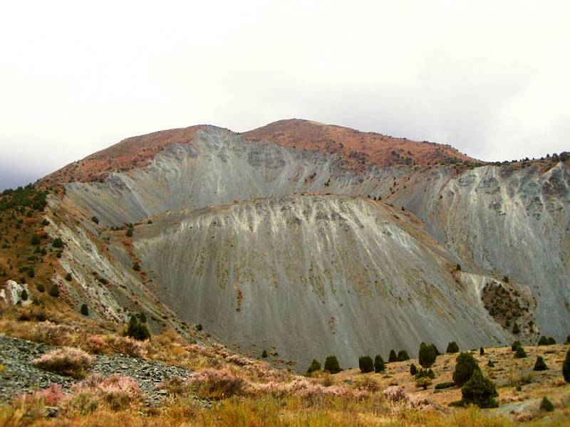
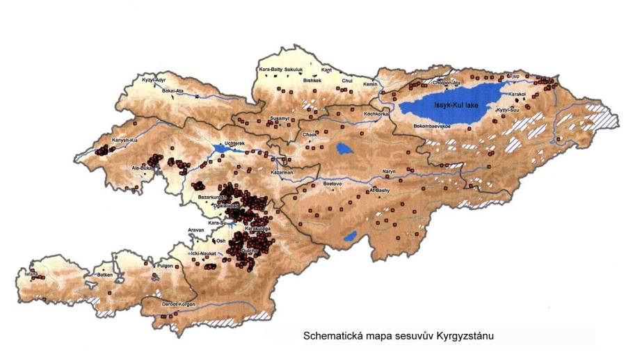
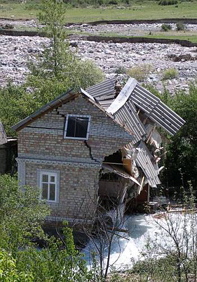
Landslides and rock avalanches cause much economic damage and numerous casualties, tens of people being killed every year. Over the last ten years almost 8 000 houses have been destroyed by landslides, on average about 660 houses per year during this period. As a result of a recent landslide 1.5 mil. m3 in volume that took place on 22 April 2003 in the village of Kara-Taryk in southern Kyrgyzstan, 38 people including 22 children were killed. Almost exactly on the same day one year later on 27April 2004, 33 more people were buried and killed under a landslide in the same region. A total of 20 landslides were recorded during April 2004 alone, and two more people were killed by a landslide on May 11, 2004. The majority of dangerous landslides occur at intermediate and lower altitudes, tending to be rarer in the high mountains. About 90% of 329 localities registered as being at high risk of destructive landslides lie in the Dzhalalabad and Osh regions in the southern part of Kyrgyzstan. Some landslides, however, are the result of disturbances of slope stability caused by human activities.
Landslides also endanger the installations at Maili-Suu uranium deposit where tailings ponds and dumps could be swept away and subsequently pollute large parts of the adjacent areas. Lakes that originate through blocking of a river by a large landslide are a specific case of combined hazards. When a lake of large volume is formed behind a landslide dam, catastrophic floods can occur when further landslides or debris avalanches flow into the lake so that water is displaced and the retaining dam is ruptured.
Debris-flows:
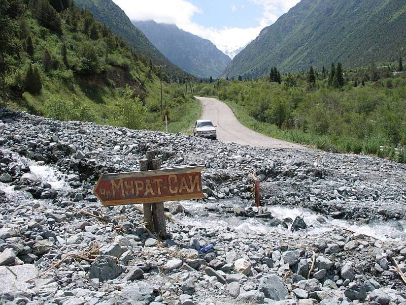
Debris-flows are another type of hazard. In contrast to landslides, these occur in high mountainous areas. These flows are, in fact, mudflows containing a high proportion of boulders or blocks of rock that have their source in the apical parts of mountain ranges after torrential rains. They are characterized by high velocity and strength. Such a mass of water, soil and stones is able to carry grown trees and boulders or blocks of rock weighing a few tens of tons over considerable distances. Because these debris-flows occur at higher altitudes in mountain areas with almost no permanent settlement and little advanced infrastructure, they do not cause any extensive economic damage or casualties. The majority of the rocky material is deposited on the valley bottom during the first kilometers of the path of the debris avalanche so that settlements in the lower parts of the valley are hit mostly by a strong stream of water. Nevertheless, valleys that serve for recreation purposes such as the Ala Archa valley and the adjacent side valleys are exposed to dangers from such events. The recreational center at Kashka Su with weekend houses and cottages was damaged by recurrent floods in the years 2003 and 2004, while debris-flows destroyed a road at the mouth of the Karagay-Bulag valley and also endanger other parts of the frequently visited Ala Archa National Park and other localities on the northern slopes of the Kyrgyz range.
Floods:
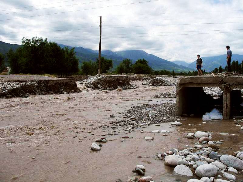
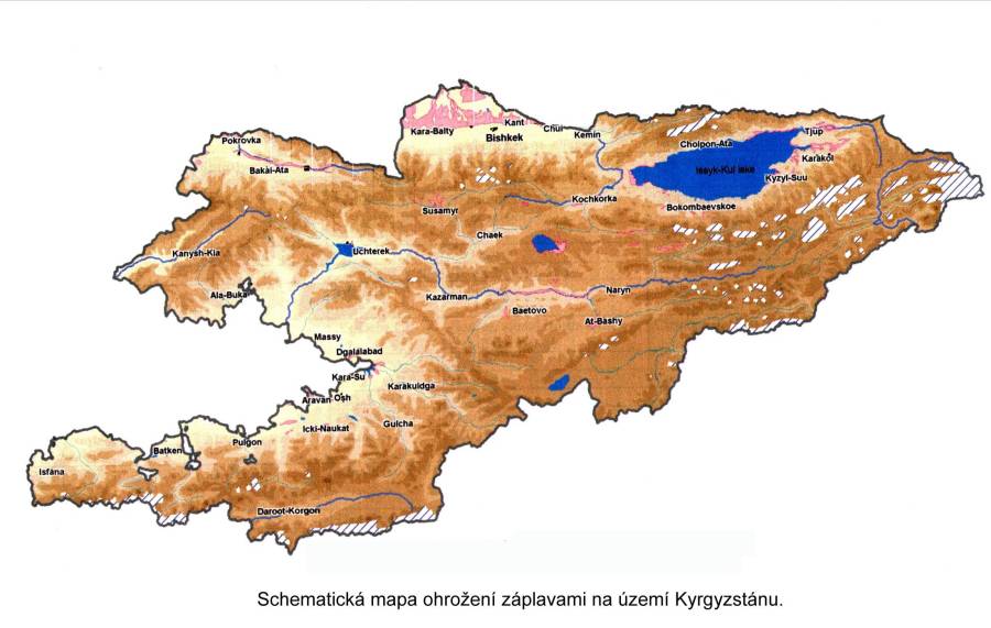
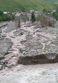
Flooding by swollen rivers mostly affects the flat lands in broad valleys occupied by large rivers. These areas are the most densely populated and economically exploited so that, relative to other natural phenomena, economic damage caused by floods can be large. The largest floods usually affect the broad alluvial plain of the river Chu where the urban agglomerations of the cities of Bishkek and Tokmak are sited. Other areas at risk include the middle reaches of the river Naryn, the Talas river valley and the eastern and northern lowlands in the environs of Lake Issyk-Kul, including the city of Karakol and certain other localities. Altogether 182 towns and villages are considered to be at risk from floods.
Glacier lakes outbursts :
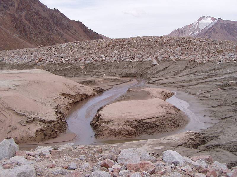
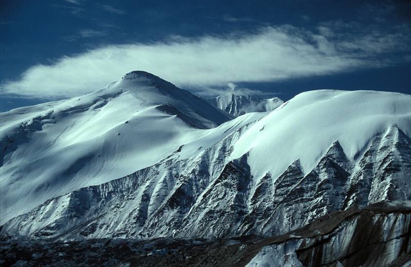
Outbursts of water from alpine lakes occur most frequently in those parts of the higher mountain ranges where the lower sections of glaciers have been subject to the effects of climate warming Intense thawing of glaciers has been taking place during recent years so that lakes have grown rapidly behind terminal moraines and landslides below the retreating snouts of glaciers. More stable conditions in the extensively glaciated regions in the highest parts of the central Tien-Shan and Pamirs mean that failures are unusual there.
Most of the alpine lakes that are likely to fail lie on the northern slopes of the Talas and Kyrgyz ranges in the environs of Lake Issyk-Kul, on the northern slopes of the Terskey Ala-Too range and on the southern slopes of the Kungey Ala-Too range. These areas are at risk of major damage because they are relatively densely populated and have developed infrastructure. Other hazardous lakes occur in the Chatkal range in western Kyrgyzstan and on the northern slopes of the Turkestani and Alay ranges in the south-west of the country. In recent years, the danger from lakes dammed by landslides has grown significantly due to the increasing frequency of torrential rains which can trigger landslides and debris avalanches. When these collapse into a lake, they cause overflow and failure of the dam. Because of the large volumes of water contained in lakes of this type, any breakout of water has a much more catastrophic impact than in the case of alpine glacial lakes.
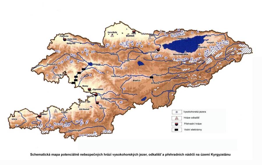
Based on the catalogue of lakes from the year 1999, a total of 287 lakes in the territory of Kyrgyzstan are susceptible to failure and, of these, 63 could fail during the next few years. Each year, there are twenty lakes that are in acute danger of failure.
Earthquakes:
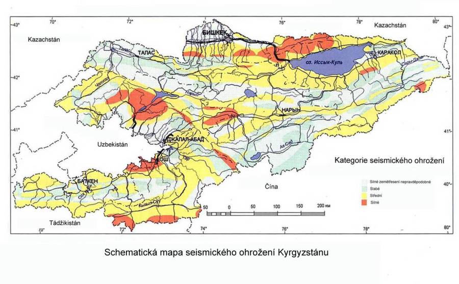
The high mountain ranges of Kyrgyszstan lie within a belt of intense tectonic activity. The whole territory is seismically active and earth tremors occur frequently. The most active zones coincide with the Kyrgyz and Kungey mountain ranges along the northern border of the country and follow the deep Talask-Fergan master fault that runs in a NW – SE direction across the whole of west Kyrgyzstan. Seismic evidence shows that these zones are at risk from earthquakes reaching a strength of 9 on the Richter scale.
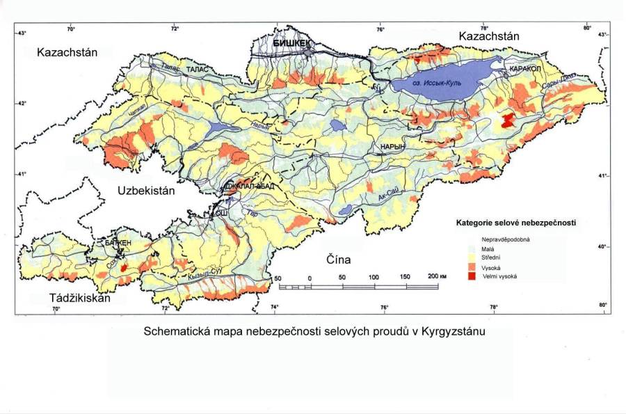
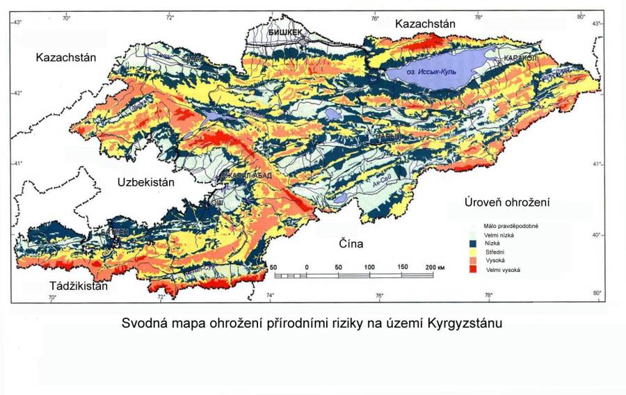
THE COMBINED MAP OF NATURAL HAZARDS in Kyrgyzstan indicates that the majority of sites at risk are located in the northern part of the country, south of the capital of Bishkek, in the environs of Lake Issyk Kul, and also in areas adjacent to the eastern and southern part of the Fergana valley. All these regions are also densely populated so that every natural catastrophe will cause significant economic damage and a large number of casualties.